


Offline Maps, GPS, Speedometer
3.3210.00 Reviews
App Specs
- Version
- 1.4.7
- Updated On
- License
- Free
- Downloads
- 10,000,000+
- Developer
- WE CENTER
- Categories
- Maps & Navigation
- Platform
- Android
Screenshots

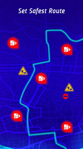
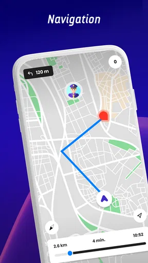

 Analysis by AppCompare
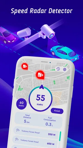
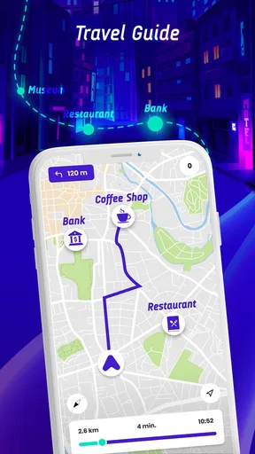
I would treat Offline Maps, GPS, Speedometer as a navigation companion to test on familiar roads before trusting it on an important journey. Its appeal is easy to understand: it brings map-related tools together with a focus on driving, including speed-camera, police, and traffic alerts. That can be handy when I want more awareness on a route, but it is not a substitute for paying attention to the road or checking that a route suits my needs.
For a driver who often travels through areas with unreliable mobile service, the promise of offline maps is especially relevant. For someone who mainly wants the dependable routing and polished guidance of a familiar major navigation service, the extra alerts may not be enough to justify changing habits. My view is that this app is most useful as a practical option to explore, not an automatic replacement for every map already on your phone.
What the free option is worth
The app is free to install, with optional in-app purchases priced from $4.99 to $29.99 per item. That makes it possible to try the basic experience before deciding whether spending anything makes sense. I would not assume that a paid item is necessary, or that it unlocks a particular feature, without checking the purchase details shown in the app itself.
That distinction matters for navigation. A free download can be good value if it covers the routes and tasks you actually need, while an optional purchase is worthwhile only if its specific benefit solves a real problem for you. If you are just curious about offline mapping or want to see how the driving alerts fit your routine, begin without paying and evaluate it in a low-pressure setting.
Offline Maps, GPS, Speedometer is made by WE CENTER and sits in the maps and navigation category. It has a 3.3 average from around 18,000 ratings, which suggests that experiences are mixed rather than universally smooth. That is not a verdict on your own phone or routes, but it is a reason to test it rather than rely on its feature promise alone.
The app has passed 10 million installs and is rated for Everyone. It was released on May 16, 2023, and the current version is 1.4.7, with Android 7.0 as the minimum operating system. Those details make it broadly approachable for compatible Android devices, although an install count cannot tell you how well it will perform in your particular area.
How it can fit into a real drive
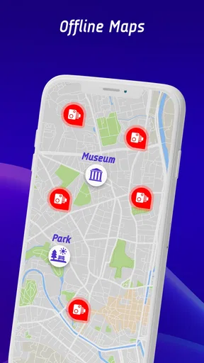
The most useful way to approach the app is to think in terms of a specific trip, rather than expecting it to be a universal driving solution. Imagine leaving a city for a weekend visit where the final stretch crosses an area with patchy reception. An offline map could help keep the route available when a live connection becomes unreliable, while the driving alerts may add another layer of awareness along the way.
Worth Reading Before You Choose

Baby Panda World Brings Quick Play to Modern Phones, but Its Game Library Feels Busy

ESPN’s Live Game View Makes Following Close Games Easier

QuizzLand Review: A Good Fit for Short Trivia Breaks, Not Every Player

Basketball Stars: Multiplayer Is Fast, but Can It Recover When Matches Go Wrong?

WEBTOON Turns Phone Updates Into a Better Reading Routine

Link to Windows Runs on Shared Habits, Not Social Feeds
For that scenario, preparation is part of using the app well. Before leaving, check that the relevant map area is available offline and confirm that the route looks sensible while you still have a reliable connection. This is a small but important habit: discovering a map is not ready after reception disappears is much more frustrating than checking it at home.
I would also keep a second navigation option available for unfamiliar or time-sensitive journeys. Offline access is valuable precisely when connectivity is uncertain, but route choice and local road conditions still deserve a fresh look. Treat the app as a useful backup or companion until you have seen how its maps behave on the roads you travel most.
The camera, police, and traffic alert focus is aimed at drivers who want more than a line on a map. In everyday use, alerts are most helpful when they arrive early enough to inform calm decisions, not when they tempt someone to stare at a screen or react abruptly. Set up a route before moving, keep the phone positioned safely, and let any warnings support attentive driving rather than replace it.
A less obvious use case is planning a route around the weakest part of a journey. If you know that a rural section regularly loses signal, you can check the map and destination beforehand and make sure you are not depending entirely on a live search once you reach that stretch. This workflow is more reliable than waiting until the connection has dropped to find out what the app can still show.
Another practical trade-off is deciding which app should be open when driving. If your usual navigation service already gives you reliable directions and traffic information, switching between apps can create needless distraction. I would use this one where its offline-map or driving-alert focus answers a particular need, rather than running multiple navigation screens and trying to compare them on the move.
Where it differs from familiar navigation apps
Most people already know the standard pattern of a map app: enter a destination, choose a route, and follow turn-by-turn guidance. Offline Maps, GPS, Speedometer stands out by combining its offline-map identity with a driving-safety emphasis on speed cameras, police, and traffic. That emphasis may suit someone who wants those considerations close to the navigation experience, but the general idea alone does not establish that its directions will outperform a well-known alternative.
Established navigation apps are often the more comfortable choice when you value familiar interfaces, broad local knowledge, or a service you have already tested on your regular commute. A dedicated offline map may be preferable when signal loss is the main concern. The sensible comparison is not which app has the longest feature list; it is which one reliably handles your routes, remains readable in the car, and gives you information without adding distraction.
One useful test is to compare the same familiar route in both apps while parked. Look for whether the route is understandable, whether key turns are easy to anticipate, and whether the offline map remains available after you disconnect from mobile data. Doing this before a long drive helps reveal practical friction without putting you under pressure on the road.
Because the app’s rating is moderate, I would pay attention to small usability details during that trial: how easily you can find a destination, whether the map view is legible at a glance, and whether alerts feel helpful or distracting. These are personal fit questions, not details that a headline feature can answer for every driver. If the experience feels awkward while parked, it is unlikely to become more comfortable in traffic.
Trade-offs worth considering
Offline navigation has a clear limitation: a map saved for use without a connection cannot automatically guarantee that every route detail reflects current conditions. Live traffic information, by its nature, is most useful when the app can receive updates. I would therefore avoid treating an offline map and real-time traffic awareness as interchangeable; they solve different parts of the journey.
Likewise, camera and police alerts should be treated as prompts for attention, not assurances about what is ahead. Alerts can be incomplete, late, or irrelevant to a particular driver’s situation. The safer and more useful mindset is to follow posted signs and local rules regardless of what the screen reports.
There is also a cost-related trade-off. Free access makes experimentation straightforward, but the presence of purchases means you should check what an item includes before buying it. The listed purchase range is $4.99 to $29.99 per item; it does not, by itself, tell you which purchase is useful for your needs. I would only spend after identifying a concrete feature or benefit that matters to your own driving.
The 3.3 average is worth reading in context: it points to a divided reception, but it does not tell me whether a complaint concerns a particular device, route, or expectation. Instead of treating the score as a reason to dismiss the app outright, I see it as a reason to keep expectations measured and check performance on a route where a mistake would not leave you stranded.
Battery and screen attention are sensible considerations for any navigation app, especially on a longer drive. I would start with a charged phone, use a secure mount, and avoid changing settings while moving. These are ordinary precautions, but they matter more than squeezing every possible alert onto the display.
Who is likely to get the most from it
I can see this app being useful for drivers who want to explore offline maps, travel through areas with inconsistent reception, or have a particular interest in camera, police, and traffic warnings. It may also appeal to someone who wants to test a free navigation option before deciding whether it deserves a place in their regular routine. The strongest case is a specific need, not simply a desire to install another map.
It is less compelling for a driver whose current navigation app already handles familiar routes well and who rarely loses coverage. It is also not the right choice for anyone expecting alerts to replace safe driving or guarantee a trouble-free route. If you depend on precise, current conditions for every trip, compare it carefully with the service you already trust rather than making an immediate switch.
For a new user, I would start with a short, familiar journey. Explore the map and alert behavior while parked, then see whether the route remains useful in the conditions you actually encounter. If that test goes well, prepare an offline area before a longer trip. This gradual approach gives you a practical answer about fit without relying on broad claims or risking an unfamiliar setup at the worst moment.
My buy-or-skip verdict
I would try Offline Maps, GPS, Speedometer if offline map access or driving alerts address a genuine gap in your current setup. Its free installation lowers the barrier to testing, and the combination of navigation and driving-focused warnings gives it a clear purpose. I would keep a proven alternative available until I had checked route quality and offline behavior for myself.
I would skip paying for an in-app item unless its description clearly matches something I need. The purchase range makes it especially sensible to decide feature by feature rather than assume that buying more will make the app a better navigator. For many drivers, a careful free trial on everyday roads will be enough to decide whether it deserves further attention.
Overall, this is a potentially useful companion for drivers who value offline preparation and added road awareness, but not a tool I would trust blindly. Its mixed rating, the limits inherent in offline information, and the need to treat alerts cautiously all argue for a measured trial. My recommendation is to test it on a familiar route first, then keep it only if it makes your own driving routine clearer and calmer.
Pros
- Download maps in advance for navigation without mobile data.
- Speedometer displays your current speed while traveling.
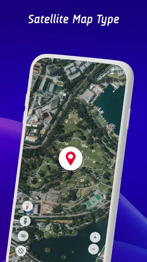
- GPS positioning helps you locate yourself on the map.
- Useful for trips through areas with weak or no internet coverage.
- Combines offline maps
- navigation tools
- and speed tracking in one app.
Cons
- Offline maps must be downloaded before you lose internet access.
- GPS accuracy can drop indoors or in areas with obstructed sky.
- Map downloads may use considerable storage space.
- Speed readings may differ from your vehicle’s calibrated speedometer.
- Offline navigation may lack live traffic and other current road updates.
FAQs for Offline Maps, GPS, Speedometer
What does Offline Maps, GPS, Speedometer do?
Offline Maps, GPS, Speedometer is designed to combine navigation tools with location and driving information. Depending on the features available in your version, you can use maps for route planning, check your GPS position, and view speed-related details while traveling. The exact map coverage and tools may vary by region and app version, so review the in-app options before relying on it for a specific journey.
Can I use Offline Maps, GPS, Speedometer without an internet connection?
Offline map navigation generally requires the relevant map area to be downloaded or saved in advance. GPS positioning can often work without mobile data because it receives signals from satellites, but internet access may still be needed to download maps, search for places, or obtain live traffic and updated route information. Check that your destination area is available offline before setting out.
How accurate is the speedometer, and can I rely on it while driving?
A GPS-based speedometer estimates speed from location changes, so its reading can differ from a vehicle’s dashboard or roadside speed measurement. Accuracy may be affected by weak satellite reception, tunnels, tall buildings, weather, or device placement. Treat the display as a helpful reference rather than a certified measuring instrument, and always follow posted speed limits and local road rules.
Does Offline Maps, GPS, Speedometer provide turn-by-turn navigation and live traffic?
Navigation and traffic features can depend on the app’s current version, your location, and whether you are connected to the internet. Offline maps may support basic route guidance where map data is saved, while live traffic and some search or rerouting functions typically require a data connection. Confirm which features are available for your route before you travel, especially if you expect to be offline.
What should I check before downloading or using the app on a trip?
Check that your phone meets the app’s operating-system requirements and has enough storage for any offline map downloads. Review location permissions, battery use, and the app’s privacy information, since navigation tools need access to location data. Download maps while connected to Wi-Fi, test the route beforehand, and keep a backup navigation option for areas with poor GPS reception or incomplete map coverage.


